Frost Possible Sunday & Monday as Temps Drop To 30's

Cold Front To Move In This Weekend

The first real cold front of the 2023-2024 cold weather season will move through late Friday and into Saturday. A very few scattered showers will be possible during the day on Friday, and even into Saturday morning, but by mid day Saturday the front will be through. Then Sunday morning temps will plummet into the upper 30’s. Below is the most recent GFS model run with projected temps. Check out Sunday and Monday lows, we could even have our first frost of the Fall in some areas.

Image Courtesy of Weathermodels.com

How Much Rain Will We See?

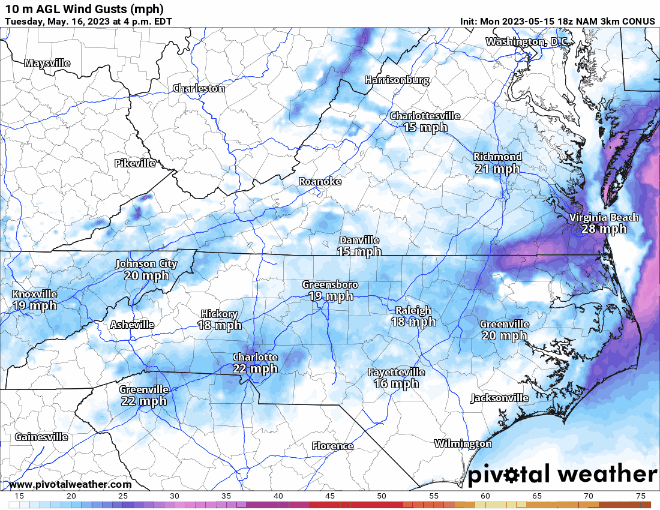
Very minimal unfortunately. The drought around the area continues to deepen and this front won’t bring much to aid. This will begin to effect leaf season as well. Leaves are already faintly changing and letting loose, leading me to believe that color this year will be dismal. Winds this weekend will also knock off many leaves possibly before they even change due to the drought. Winds will gust to 20mph throughout the day on Saturday and Sunday. This will increase the wildfire threat around the area as well. With very limited rainfall in the 7 day forecast, the drought conditions will increase. Burning leaves is not recommended at this time.

Long Range Drought Relief

Signs on long range models point to another front moving through sometime during the middle of next week. The GFS shows a Gulf low whereas the Euro shows a form of a cutter. The Gulf low would certainly bring a good chance of rain for WNC into next weekend, but there is without a doubt uncertainty as to how that front will unfold. Check back soon I will keep you updated on the unfolding pattern!

Higher Than Average Snowfall Projected For WNC For 2023-2024 Winter

Strong El Nino To Develop, Wetter Winter On Tap For WNC

A strong El Nino is in the process of coming to fruition and that historically has meant more precipitation flowing through NC during the winter months. Of course there is limited long range forecasting ability, but what we can do is compare and contrast from years in the past. NOAA recently released their winter forecast outlook based on upcoming patterns expected with Strong El Nino development. I share those same sentiments as I believe we could be in for a harsh winter here in WNC as well. If you have just moved here in the past two years or so, you may not have experienced the type of winters possible in the mountains of WNC. It appears as though you have a good likelihood of getting a really taste of a strong WNC winter this year.

AshevilleWX Projected Snowfall Map For Winter 2023-2024

What Is El Nino?

El nino is when temperatures of water far out in the Pacific Ocean in a specific region drift higher than normal for more than 3 consecutive months. This higher than normal water temperature creates instability for low pressures to develop. With these frequent low pressures developing in this particular region know as Nino 3.4, storm traverse the Southeast with more consistency. Thus, NOAA is projecting a wetter than average January, February, & March for the Southeast (See Second Graphic Below).

Courtesy of NOAA

This projection lines up with past years where strong El Nino conditions have developed. With over a 50% chance a strong El Nino comes to fruition, there is a good chance we see excessive precipitation this winter. One year in particular that sticks out to me is 2009-2010 for WNC. That year many locations around Asheville received over 40” of snowfall! There is a chance this could happen again as it feels like we are due for a strong winter here in WNC.

What Is The Average Around WNC?

Below you can see the Average Annual Snowfall Map provided by the National Weather Service In Greer, SC. Downtown Asheville averages around 12.6” of snowfall whereas the Asheville Airport on averages 11.1”. If projections are correct, Asheville could see 14”-18” of snowfall this coming winter. Similar math can be done for the surround areas.

Courtesy of GSP NWS

Uncertainty In Long Range Forecasting

I had stopped dong my long range winter forecast for a few years, but each year I get asked countless times if I am going to release it. My answer the past couple of years has been no due to so much uncertainty with the mountains of WNC. I mean we struggle to nail a forecast down 3 days up here. So how can we long range forecast with any certainty? Those were the questions I proposed to myself. I want to be known as truthful and honest, so I put the forecast off for the past few years. Today it returns because I think it is interesting to compare historical data and make projections for the future. Many industries do this, and the weather should be no different. Is there a chance this forecast is wrong, certainly! But understanding how moisture comes to fruition during winter is important, and long range forecasting allows us to set some perimeters for possible exceptions. Look for my forecasts to pick up here as we head into the winter and cold shots begin to show! Check back soon!

Wash Out Of A Week In Store For WNC, 3"+ of Rainfall Possible

Models continue to show an Upper Level Low moving through WNC early this week and stalling across the State of NC. As it stalls it will dump buckets of rainfall all week on the area. Flash flooding will certainly be possible around the area, as most areas will see 3”+ of rainfall through Friday evening. Locations along the Blue Ridge Escarpment could rake in over 6” of rainfall as the orientation of the flow really enhances along these area. Below is the most recent model data showing what is possible as the week progresses. Remember that these upper level lows are difficult to predict, and sometimes they bring with them a multitude of surprises.

Model Data

The most recent GFS shows shows many areas around WNC receiving over 3” of rainfall through Friday PM. Also notice the temperature spread for the next several days. The GFS is showing temps only getting into the low 60s on Wednesday! This would shatter a record low high temperature 71 degrees set back in 1890! So to recap, the GFS is showing the temperature only getting in the low 60’s on June 21st, this hasn’t happened since June 21st, 1890 when the temperature only got to 71 that day. That should show you how cool we are going to be in comparsion to what it normally feels like in Asheville in the middle of June.

All Around Nasty Week In Store

With the kids out for Summer, this will not be the week to be at the pool unfortunately. Might be a good time today on Fathers Day to run out all of that energy, because it is going to get soggy around WNC over the next week. Then all eyes will turn to a tropical wave in the Atlantic and what that will provide for July 4th weekend. Stick around for more info, I have another update here soon as more information become available regarding the upper level low!

Strong Storms Likely Tomorrow Evening(May 16th) Around WNC, Tornados Can't Be Rule Out

Strong Storms Likely For WNC Tomorrow Evening

Models indicate that a strong line of storms is likely to move through WNC late tomorrow evening and could bring with it damaging winds, hail, and even an isolated tornado could be possible. Below is the most recent depiction from the NAM 3km that shows the possibility of the what could move through.

Nam 3km Courtesy of Pivotalweather.com

Timing?

Timing is a bit difficult here because daytime heating could pop off some storms ahead of the main front between noon & 6pm. Then the main line will push through later tomorrow evening. Timing is a bit difficult to nail down just yet but the main line looks to move through between 6pm-9pm tomorrow evening.

Storm Fuel(CAPE) In Place Tomorrow

High levels of CAPE will build tomorrow as the day progresses around WNC. As this instability builds in the boundary layer throughout the day, its potential will begin the be released as the cooler air from the cold pool aloft moves overhead. Look for the skies to look a foggy white as the afternoon builds, before they darken and storms appear on the horizon. Below you can see the levels of CAPE that will be present tomorrow afternoon. Anything over 1500/jkg in my opinion will pop off large storms capable of damaging hail in the WNC area, especially South of Asheville.

CAPE Forecast for Tuesday Afternoon Courtesy of Weathermodels.com

NAM 3km Wind Gusts For Tuesday Afternoon

Damaging winds and tornados could be possible around WNC tomorrow. Though rare in WNC, we can have tornado’s and in fact we did have a small EF-0 Tornado last week in Henderson County that did some damage to a home. These type systems have the chance to produce those spin ups. Below you can see the wind gusts per the most recent NAM 3km and also the Significant Tornado Parameter, which compiles several data points that a dominate in tornado creation. As you can see some areas around WNC could get as high as a 4 on the scale! Please be careful tomorrow afternoon around WNC.

Wind Map Courtesy of Pivotalweather.com

STP Courtesy of Weathermodels.com

Severe Prediction Center Has Issued A Slight Risk

From Asheville to Boone and all around WNC tomorrow afternoon will be a dangerous afternoon for weather. Below you can see that all across the State there will la chance for severe weather. I will do my best to post updates but have several sources of media to get your reports! Check back soon for a YouTube update!

Damaging Winds Likely For WNC Saturday Afternoon...Gusts Over 60MPH

Winds Gusting Over 60mph Possible For WNC Saturday Afternoon

A strong low pressure will strengthen over the Midwest and that will send a line of storms towards WNC. After this line passes, the backside upper level energy will really get moving. Between 2-9pm Saturday evening winds could gust over 60mph in some locations. Sustained winds of 20-30mph will beat down trees and power outages are likely for many around WNC. Below is the most recent HRRR model run depicting peak wind gusts around 4pm tomorrow afternoon. Us today to prepare for this system!

HRRR Model Courtesy of Pivotalweather.com

Where Will Highest Wind Gust Occur?

Usually these high wind gusts remain above 3500’ but most all models have gusts over 40mph dipping into most valley locations around WNC as the day progresses tomorrow. All short range models show around 3pm winds gust around 50mph at the Asheville Airport. As you proceed into higher elevations those gust could get to 60 or even 70mph!

Now Is The Time To Prepare

With a system like this, the main threat will be power outages. Be prepared to lose power over the next 36 hours due to tree limbs falling on power lines. This is likely to happen for many families in WNC! Have a meal that can be prepared without power, and make sure if you have a well you fill up a bathtub with water in case the power goes out. Your pump won’t work without electricity.

NAM 3km Wind Gusts For Saturday Afternoon

Below you can see the most recent 12z NAM 3km run. I find these models to be a tad high with wind gust potential, but this is one of the more potent runs I have seen. Typically when it shows gust around 40mph we get winds in the low 30’s. Now it is depicting gusts to 57mph at the Asheville Airport tomorrow afternoon. Based on previous observations, winds gusts will likely be in the mid to high 40mph range. This will certainly bring down trees across the area.

Nam 3km Wind Gusts Courtesy of Pivotalweather.com

Will We See Storms?

A few rumbles of Thunder will be possible early Saturday morning as the initial front pushes through, but with the timing of these storms, I am not expecting anything too severe. We may see some type of warning go out tomorrow afternoon though for the impending wind. Rainfall will be less than .5” and shouldn’t cause any problems. Be sure and report and wind damage you see to the AshevilleWX Weather Community Group on Facebook.

Low 20's Likely Tuesday AM Around WNC After Many See Snow Showers Over Next 36 Hours

Mid March Cold Snap To Kill All Budding Trees

The fate of most buds around WNC seems pretty much sealed as all models show WNC dropping into the low to mid 20’s on both Tuesday and Wednesday AM. With most models projecting temps in the low 20’s, even high end frost protection will not suffice. Some locations could even drop into the teens, especially locations above 3000’. Snow showers will also be possible for many over the next 36 hours. Ill elaborate below.

Low Temps For Tuesday AM NAM 3km

Below you can see the 12z NAM 3km low temps for Tuesday morning. This is the coldest of the models, but does show the range at which temps can drop. I’ll also show what the GFS model is showing as well for Tuesday morning. Also remember that Wednesday morning is projected to be slightly colder.

NAM 3km 6am Temps Tuesday AM Low Temps Courtesy of Pivotalweather.com

GFS Model Tuesday AM Low Temperatures

GFS Tuesday AM Low Temps Courtesy of Pivotalweather.com

Snow Showers Possible For Many Through Tuesday AM

Convective snow showers are likely to develop in East TN sometime tomorrow and these will move towards WNC. Higher elevations will see snow throughout the day and some of these convective snow cells could break through the higher elevations and bring valley locations like Asheville a quick burst of snow. Below check out the most recent HRRR model run. You can see those streamers develop tomorrow afternoon and that will likely bring snow to many locations around WNC.

12z HRRR Precip Map Courtesy of Pivotalweather.com

Snowfall Accumulation?

I think locations above 3500’ could see 1"-3” of snowfall accumulation from this system, but I am not optimistic at the moment about accumulation below that threshold. If snow does break containment and is heavy enough, a quick dusting could be possible but I would expect it to melt quickly. The main story from this front will be the cold.

Wednesday To Be Colder Than Tuesday AM

Most models suggest that we will be even colder on Wednesday morning compared to Tuesday around WNC. Below you can see how the European model dips into the very low 20’s on Wednesday AM. This will be a serious frost and will likely kill any blooms that have already manifested. If we were going to stay in the upper 20’s I would recommend frost protection, but since most models suggest temps going into the low 20’s and the best frost protection only protecting into the upper 20’s I wouldn’t suggest wasting the time. This is extremely unfortunate, but is expected since we began seeing bloom outs in late February.

06z Euro Temps Courtesy of Pivotalweather.com

Mid March Cold To Put Damper On Early Bloom, Crop Damage Likely

Long Range Models Turn Cold, But Storms Expected Beforehand

Several of the long range models are show a devastating cold front moving through during the middle of March. This is expected, but not hoped for since many of the area fruit trees are already in bloom. This unfortunate false spring will have devastating consequences on local apple crops, and things would really go downhill if we were to get a heavy snow. Below you can see the CPC analog of the upcoming 8-14 day timeframe. It is showing the likelihood of unseasonably cold air during that time period.

Courtesy of Pivotalweather.com

As you can see above, the air that is projected to move through the area will be significantly colder than the average air we experience at this time of the year. Thus, I am expecting the chance for many crops to be damaged. Check out the European Ensemble temperature regime for the next two weeks. There is very little doubt in my mind that we will see a devastating freeze during the middle of March. Now is the time to begin preparing if you need to protect large areas of budding fruit.

You can see how this model suggests that by the middle of next week we will return to much more seasonable temperatures. I’ll certainly have more on this later as some models even indicate a last gasp shot at snowfall, but I am hesitate to trust any model after what happened 3 weeks ago..

Storms To Move In Tonight & Then Another Round Friday

Below you can see what the most recent NAM3km projects across WNC. As you can see rainfall will move in around Midnight tonight and reside by sunrise. Scattered showers could be possible tomorrow during the day, and another round of storms is likely sometime mid day on Friday. Isolated high winds and lightning could occur.

Near Record High Temps Possible Mid Week Around WNC

Spring Like Temps All Week Will Bring Bloom For Some Areas

Warm air from the coast will be pushed towards WNC all week as high pressure builds over the Atlantic. Temperatures on Wednesday could push close to the daily record high which is 77 degrees from 2018. Thursday could be even warmer! With Daffodils already in bloom for most location around WNC and tulips arriving, this will certainly not bode well for a long lasting Spring flower season. This is because the cold is sure to return…. Near the end of February things look to turn cold again, and a strong cold snap could really damage the Spring flower crop. Below ill explain.

European Model Projected Highs Wednesday Afternoon

Wednesday Projected Highs European Model Courtesy of Pivotalweather.com

Wednesday To Be Top 5 Hottest February 22nd

Below you can see a chart I have pulled from the Southeast Regional Climate Center. This shows the current model average projected for Wednesday and where that would rank among the top 5 warmest February 22nd’s on record for Asheville, NC.

Courtesy of SERCC

Thursday Could Break Records As Well

Temperatures will likely climb past the high temps we see on Wednesday and really kick off an early Spring Thursday around WNC. It will be weather to sweat in as we get close to 80 on Thursday afternoon! Below check out the most recent Euro model and its projected high temps on Thursday. This would also come close if not break a record for Asheville.

Thursday high Temps Courtesy of Pivotalweather.com

Cold To Return

As we near the end of February, the cold will certainly return! It appears as though we still have several hard freezes that will be possible so only plant those hardy veggies that can withstand a hard freeze. We can still go into single digits in March. See below the European Ensemble and its projected temps. Look at the consensus of over 70 degrees on Thursday! Then as we progress through the weekend next week the cold return. There will be another chance for wintry weather, we have about a month left to where accumulating snowfall events are possible around the Asheville area. They can happen after that, but typically it just falls as slop. Check back soon for more info on the record high temps next week for WNC!

Euro Ensemble Courtesy of Weathermodels.com

AshevilleWX Final Projected Snowfall Map February 11th-12th

AshevilleWX Final Projected Snowfall Map February 11th-12th

Uncertainty In The Forecast

This is one of the more difficult forecasts I have had to make in my career. Lots of things can happen with Upper Level Low and they are typical the storms that surprise snows come from. I have done my best to forecast this one and my projections could be wrong but I have done my best. Please use caution when traveling around the area tomorrow when the Upper Level Low is going through, heavy snowfall could occur. Check back soon for more info ill post if I see something begin to change.

AshevilleWX Initial Projected Snowfall Map February 11-12

AshevilleWX Projected Snowfall Map February 11th-12th

(Discussion Below)

Models Projecting Impactful Snow, Some Higher Than Others

We have had some pretty wild model runs this afternoon with both major global models showing 6”+ of snowfall for the majority of WNC through Sunday evening as an Upper Level Low moves through the area. Below ill show the most recent 18z Euro & 18z GFS snowfall totals.

18z GFS

Courtesy of Pivotalweather.com

18z Euro

Courtesy of Pivotalweather.com

Timing

Nailing the timing of the switchover is difficult to nail down right now, but if I had to guess many will switch to snow around 3-4am. By sunrise some locations could have several inches of accumulation. Dynamic cooling will be the main ingredient for the switchover and as precipitation gets heavier the switchover will occur. Check back tomorrow for another update as we get closer to this event.