

Wintry Weather, High End Northwest Flow Event On Tap For WNC
Another wave of precipitation will move in later this evening around WNC, and some locations could have freezing rain, sleet, or even snow fall as the precip begins. Locations closer to the Boone area have a chance to stay snow throughout a good portion of this event and another 3”-6” of snowfall looks possible for locations above 3500’ along the NC/TN state line. Models limit an frozen precipitation around the Asheville area Thursday night, but there is still a chance for freezing rain. This is a complicated system, but on the backside Friday we are very likely to see a high end Northwest Flow event. This means that snow showers will likely break containment from the higher elevations and push into the Downtown Asheville area. You can see below on the most recent Nam3km model. I look for those little fingers of moisture to push from Madison Co. all the way down through Buncombe Co. That indicates to me that a ripe channel of moisture and force will push out of the high elevations and bring precipitation to the valley floor.

Simulated Radar Courtesy of Weathermodels.com
How Much Snow Is Possible?
For locations above 4000’ along the NC/TN line I believe another 6”-12” of accumulation could be possible through early Saturday morning. As you progress down in elevation, I expect 3”-6” of accumulation between 4000’ and 3500’ along the NC/TN border, and then a dusting to 1” will even be possible around the Asheville area. High winds will carry a moist flow out of the high elevations, and with very cold temps I am thinking this is the best Northwest flow setup we have seen in a couple of years. Asheville has been known to pick up a quick inch or two from these heavy flows, so it is certainly possible. For locations South of Asheville, I think Fairview and Black Mountain should do well with this flow. Locations like Hendersonville and Brevard typically only see flurries from these type flows, but could see an intermittent snow shower if the flow is strong enough. Check out the most recent accumulation map from the Nam3km below.

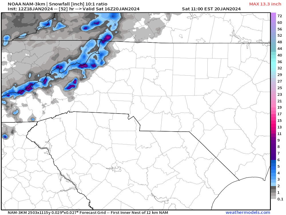
Nam3km Snowfall Accumulation Map Courtesy of Weathermodels.com
Storm Effects
This storm will affect you in many ways depending on your location. Temps will plummet into the low teens again for many early Saturday morning and that will stress infrastructure. We will also have snow showers still falling and many covered roadways north of I-40. It would be best to plan to stay home on Saturday morning if possible. Below you can see the Nam3km projected temps for Saturday AM.

NAM3km Temps 6am Saturday AM Courtesy of Weathermodels.com
Live Update Tonight At 6pm
Check in tonight on Facebook or Youtube at 6pm, I will be doing a live update to cover this event and get you prepared to what is to come! See you then.


