Asheville Closing In On All-Time Yearly Rainfall Record

All-Time Rainfall Record In Sight

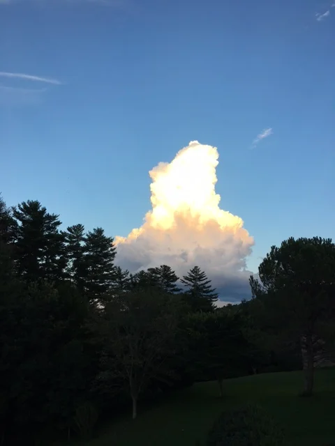
In a year where weather records have fallen, it should be no surprise that Asheville, NC is closing in on breaking the all time yearly rainfall record. Currently at the Asheville Airport, meteorologist have recorded 73.97” of rainfall for the year of 2018. The record of 75.22” was set back in 2013 during an extremely wet year… but this year has be comparable.

More Rain To Come

more rainfall looks likely to end the year as another strong front looks possible before New Years. With only 1.25” of rainfall needed, a strong frontal passage could certainly drop that. Both GFS & European models show this possibility.. so I am going to predict that we break the all-time rainfall record! It is going to be close.. but I do believe that the front that moves through before New Years will drop enough precipitation. Check back here on Ashevillewx.com to track the progression!

Trust The Local Tax Pro’s

Call (828) 684-7374 to set up your appointment today! http://www.kruseaccounting.com

Mt. Mitchell Receives 34" Of Snow From Winter Storm

NC Mountains Dig Out

Mt. Mitchell is known for its extreme snow totals during southeast winter storms, and this past storm was not different.  34” of snowfall was recorded at the peak of Mt. Mitchell, and totals over 2ft could be found in the town of Busick, which is situated near the base of Mt. Mitchell at around 3300’.

How Did It Happen

Enhanced upslope flow.  Heavy precipitation streamed in from the southeast for almost 24 hours in this particular region, and as that moisture approached this particular region of the Blue Ridge Escarpment, it condensed, and slammed into the area.  As the moisture moved up the slope of the Blue Ridge Escarpment the air compresses and becomes almost supersaturated.  Then as the flow reaches the top of the peaks along the Escarpment, it bursts into the valley below.  This is how Busick, NC received 24” of snow.  The flow was extended from the SE for some time, and that upslope orientation particularly was enhanced by the region just below Mt. Mitchell/Busick.

ExplainationofBusickSnow.png

Mt Mitchell Effects

Our Friend Kevin Cox sent in a few photos of the effect from the storm at Mt. Mitchell State Park where 32” of snow was recorded.

Kevin Standing On A Snow Drift

Snow Blown Through Cracks In Door

Need Tax Help?

Contact the local professionals at C.P. Kruse & Co. to handle all of your needs this tax season.

http://www.kruseaccounting.com

or call (828) 684-7374

Snow Presumably Blow Through Rock Wall

Snow Presumably Blow Through Rock Wall

Snow Blown Into Lodge By High Winds

Snow Blown Into Lodge By High Winds

If you have photos of the small town of Busick, NC.. please email to Hunter@Ashevillewx.com

FullSizeRender.jpg

2018 Now The Second Wettest Year In Asheville History

If You Think Its Been Abnormally Wet.. Thats Because It Has

As of 5pm on November 12th, the Asheville Airport has received just over 65” of rainfall for the year. That pushes the year 2018 past 1973, and into the position of second wettest year on record. With our wettest month ever recorded in May of 2018, its only fitting that we will make a run at the wettest year on record as we move towards December.

When Was The Wettest Year In Asheville?

2013 was the wettest year on record for the Asheville Airport. With 75” of rain falling that year, it will be difficult for WNC to eclipse that total, but it is not out of the question. With another couple of inches of rainfall/wintery precipitation expected over the next 3-4 days, the record is not out of the question, but it would seem unlikely.

Ward Enterprises Logo  black - No background .png

Looking To Build A New Home In WNC?

Contact Larry or Hunter Ward (828) 691-5000 to discuss building your dream home.

Moving Forward

The wet pattern appears to continue through next week, and with some tropical development possible.. more rainfall looks likely.  10 more inches of rainfall would be a lot, there would be more flooding on the way to breaking that record if we do.  I know that snow lovers around the area would enjoy breaking that record by way of wintery precipitation… and I guess we will see what December holds.  Check back with Ashevillewx periodically as we track Asheville’s progress towards the wettest year on record!

Set Your Clocks Backward Saturday Night

Fall Back

Remember to set your clocks back on Saturday night before you go to bed. Clocks officially set back at 2am, so if you have a clock that must be set, please ensure to do so. For meteorologist, we love it when daylights savings is over because it means that the weather models run an hour earlier. Weather models do not observe daylights savings time, and therefore a GFS model that begins at 10:30pm when daylights savings isn’t active, begin at 11:30pm when we are in daylights savings time. Waiting up that extra hour can be taxing, so I for one love to see Nov 2nd.

DaylightsSavingsTimeReminder.png

Rainfall From Michael Causing Flash Flooding In WNC

Black Mountain Streams Rise

Water on Flat Creek on Black Mountain began to rise quickly Thursday morning as Hurricane Michael moved into the area.  Here are a few videos and pictures from the flooding. 


IMAGE.JPG
IMAGE.JPG


IMG_5712.JPG

Michelle BennIson provided this picture and says Bat Creek near Crest Rd and East Blue Ridge rd in Flat Rock,NC.  In all my 30+ years living in this area I've never seen this creek this high!

Near Owen Middle School provides by Cindy Sturdivant

Near Owen Middle School provides by Cindy Sturdivant

Flooding in Downtown Hendersonville, NC sent in by Jack Hough

Flooding in Downtown Hendersonville, NC sent in by Jack Hough

Michael Now A Category 1 Hurricane, Aims For Gulf Coast

Michael Now A Category 1 Hurricane, Aims For Gulf Coast

As of the 11am update, the National Hurricane Center has upgrades Tropical Storm Michael into a Catagory 1 Hurricane. As you can see on the visible satellite, hot towers going up around the center of Michael, and that will likely continue to strengthen it. Shear looks to relax one relax next 36 hours in the upper atmosphere, and that could allow Michael to make a run a category 3 status. The track for Michael is still a difficult one to nail down due to how it will interact with a trough moving across the US.

Gulf Coast States Prepare For Development Of Michael

Long range models have been keying on the possibility for tropical development in the Gulf of Mexico, and now the NHC is giving Michael a 90% chance for development over the next few days.  There are a lot of factors to consider though with this forecast.

1. How will Michael interact with the trough that will be moving across the central portion of the US. 


6z HWRF inner nest radar depiction Wednesday Morning

6z HWRF inner nest radar depiction Wednesday Morning

2. How strong will Michael be when it makes landfall on the Gulf Coast?

3. Will Michael move through WNC after it makes landfall? 

4. How cold will it be after the cold front passes through next weekend? 


Michaels Landfall


FullSizeRender.jpg

Above you can see the 6z NAM 3km simulated radar depiction.  There is a bit of moisture showing up in Mississippi and that would signify the front coming through.  This front will be what pushes Michael back out to sea.  So it’s a huge player.  Depending on how far west Michael moves will determine how much rainfall WNC receives.

Michaels Impact On WNC


FullSizeRender.jpg

so models depict Michael moving directly over WNC (GFS).  Others (Euro) believe that the trough will be too strong and that will sweep Michael out to sea quickly.  So what were are dealing with is a classic tropical setup.  The trough sweeping across the US will sweep the storm out to sea.. but when?  Will the trough finally catch the storm when it reaches NC like the GFS states, or will the trough catch the storm just after landfall and sweep it out much quicker.  These are the difficult details to nail down, but they are crucial to the end forecast.  We will have a better idea in the next 36 hours regarding the development of Michael, so please stay attentive, and check back soon for another update!

Heavy Rains This Morning Cause Flooding On Highway 9, Landslide On Lower Sand Branch Rd. In WNC

Training storms have remained nearly stationary this morning or portions of Southeast Buncombe Co. and that had lead to flooding in the area.  A landslide occurred early this morning along Lower Sand Branch Rd. Off of Highway 9 near Bat Cave, NC, and flooding on Highway 9 have made travel in the area dangerous.  Please turn around, don’t drown!


IMAGE.JPG

The radar continue to indicate that rainfall will remain in the area for the next few hours so please be careful if you have to travel Highway 9, some road may become impassable.


FullSizeRender.jpg
IMAGE.JPG
IMAGE.JPG

Hurricane Florence Makes Landfall On Wrightsville Beach, NC As Cat 1 90mph Storm.

Hurricane Florence has finally made landfall in Wrightsville Beach this morning at aprox 7:15am.  Winds are estimated at 90 mph.   On shore flow has cause extreme flooding in places like New Bern, NC where numerous rescues have taken place this morning.  Florence is expected to creep towards WNC, and eventually cause flooding problems even in the mountains.  Rainfall totals could exceed 10” in some locations along the Eastern Blue Ridge Escarpment.  Ashevillewx will have all the info, so check back this afternoon for another video update!

FullSizeRender.jpg

6:36am Wilmington Radar Florence Landfall at Wrightsville Beach, NC. 

Gordon Becomes First US Landfalling Tropical System of 2018 Season

Gordon Becomes First US Landfalling Tropical System of 2018 Season

Tropical Storm Gordon has developed just off the Gulf Coast of the US and will move onshore later this evening and into tomorrow.  Some models suggest that winds could be in excess of 70 mph, which would make Gordon the first landfalling Hurricane of the 2018 season.  

Rare anti-crepuscular rays produced by cloud as it appears to be set on fire during WNC sunset Time-lapse include

A rare and incredible sunset lit up the sky around WNC last night (September 3rd), and small supercells that had pop-up around sunset were set ablaze. 

Time-lapse from Hendersonville, NC provided to Ashevillewx by Paul Jackson

These updrafts were in a relatively dry atmosphere aloft, so the cloud debris didn’t spread out.  As the sun sets, the rays refracting around the earths surface fade and since red wave lengths are longer they linger the longest. These cloud are 30000ft in the air, so they see sunlight for long compared to the earths surface!  You can even see some hints of mammatus clouds showing up in the photo from Black Mountain.  Also, an interesting phenomenon known as anti-crepuscular rays can be seen from a few photos, especially from the one below near the Asheville Airport.  I have never seen a cloud top produce anti-crepusuclar rays and have only seen photos of mountains producing them.  It is a rare occurrence for sure.  

Photo taken from near the Asheville Airport and provided by Sara Bender Hope

Photo taken from Brevard, NC and provided by ColinKirkman

You can see how the top of the cloud almost looks on fire, and the rays of light are absorbed and bend around the structure.  At the base of the cloud you can see the red of the light spectrum.  Those last lingering rays that bend around earths surface as the sun retreats.  These rays hit the base of the cloud with a hue of red, because they have traveled farther than any other.  One can see that since the top of cloud is higher, the sun can still hit it because if the angle in which the light is traveling.  In a sense this represents the light spectrum, and could be used to prove that the earth is round.  I as a meteorologist get caught up on the anti-crepuscular rays coming from behind the could, but there is just so much to marvel at in these various photos.  

Photo taken in Etowah, NC provided by Jennifer Young

Photo taken from Mills River, NC proved by Michelle Johnston

Photo taken from Black Mountain, NC provided by Roxie Nation

Photo from Candler, NC taken by Stephaine Harris

Photo from Canton, NC taken by Carol Larsen

Usually these cells will spread out and winds aloft will blow cloud debris in a way that obscures your view from seeing the entire updraft.  Luckily last night, unique conditions were set up, and it appeared to many that these cells we on fire!  Thanks for sharing!

Photo taken from Travelers Rest, SC and provided by Stella Galyean

Photo taken from Fairview, NC by Mary Deckard

Photo sequence taken from Flat Rock, NC and provided by Didi Salvatierra

How will excessive amounts of rain this year affect Fall color around WNC?

How will excessive amounts of rain this year affect Fall color around WNC?

The short answer is yes, it will.  Unfortunately, abundant rainfall is not part of the recipe for vibrant fall color in WNC, simply because it prolongs the process.  Chlorophyll is supplied to the leaf a few days longer compared to normal, and the cork barrier struggles to form.  Typically during late October and early November we will have a strong line of storms move through WNC.  Winds gusting over 40mph blow off these leaves that have just begun the color changing process, and we never get to see them fully change.

Can Asheville Break The All Time Yearly Rainfall Record This Year?

Can Asheville Break The All Time Yearly Rainfall Record This Year?

 As fronts race across the US, they are met with the resistance of a moist, southerly flow.. and storm development occurs.  Dominate high pressure has consistently developed off the Southeast Atlantic Coast during 2018, and this is what has caused the excessive surge of moist air.