
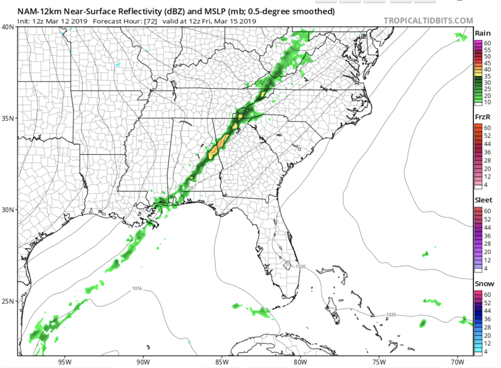
It seems as though we are in a rinse-wash-repeat cycle in WNC where we can only manage 2-3 dry days in a row. Tuesday and Wednesday of this week will be our dry days, and then Thursday afternoon clouds will move in along with another system. In fact, this will be a remnant piece of energy on the tail end of the recorded breaking low pressure that will move across Colorado, and then the Midwest. I expect to see severe storms all across the SE over the next 2-3 days, and even a few rumbles of thunder cannot be ruled out late Thursday or early Friday into WNC.
12km NAM Forecast GIF for next 84 hours courtesy of tropicaltidbits.com

Taxes Have You Down?
Call the local trusted professionals at C.P. Kruse and set up your tax appointment today! I promise you that they will take care of all of your accounting needs without any hassle! Call (828)684-7374 or visit Kruseaccounting.com to set up your appointment today!
Northwest Flow Snow Showers Possible Late Friday & Into Saturday Especially In Higher Elevations
On the backside of the low pressure that moves through the area Thursday into Friday, some isolated snow showers could be possible. Winds could gust over 40mph in some valley locations, and I think believe that that will propel flakes out of the highest elevations and into the valleys below. The main takeaway right now is that northwest flow flurries/snow showers could be possible around WNC Friday & into Saturday. I will keep my eye on this and continue to update you when necessary.

