

It has been a gorgeous week around Western North Carolina, and that will continue today as many locations push for record high temperatures. I am forecasting a high temperature of 71 which would tie the record high for February 7th, but many locations will rise even higher than that this afternoon! Some scattered showers could be possible late, but nothing more than .25” or precipitation is expected. Looking ahead to the weekend, we will cool down considerably as this front moves through. Temperatures will dip into the 20’s Saturday morning at the surface, and some overrunning precipitation could advect out well in front of a surface low located in Texas.
Freezing Drizzle Cannot Be Rule Out
I could see the potential for some slight icing, especially along the southern portion of The Blue Ridge Escaprment, but surface temperatures will be moderate since we have been so warm lately. Therefore, I am not overly concerned about this potential, but it is noteworthy that the possibility exists. I have my eye on short range models, and below you can see the most recent NAM 3km, and how it depicts moisture moving in over a frozen column. Depending on how high dew points are around WNC, will determine if the precipitation actually makes it to the surface. If it does, surface temps Saturday morning will be in the upper 20’s and elevated surfaces could see some form of light ice accretion.

Nam 3km Simulated Radar For Saturday at 8am Courtesy of Weathermodels.com

Tax Season Is Here
Bring your personal or business taxes to the local pros at C.P. Kruse & Co. located on Hendersonville Hwy! Give them a call today to set up your appointment! (828)684-7374 http://www.kruseaccounting.com

Projected Temps Saturday Morning At 8am Per 3km Nam Courtesy of Weathermodels.com
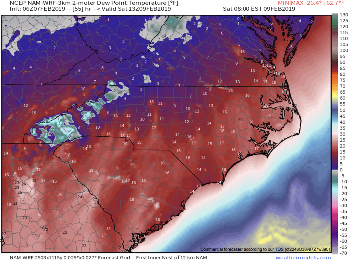
Projected Dew points Saturday at 8am per 3km Nam courtesy of Weathermodels.com
As you can see those are some very low dew points so it is very questionable as to whether or not this moisture makes it to the surface. I will be watching these dew points over the next two days to see if they increase. If they do, then the likelihood of precipitation making it to the frozen surface will increase. I believe we could see light moisture again move in Sunday morning as temps dip below freezing. These small scale icing events are poorly modeled in many cases, especially around WNC.. so join me live tonight in the AshevilleWX App at 8pm where I will detail out my thoughts on the potential, and what the most recent models show!

