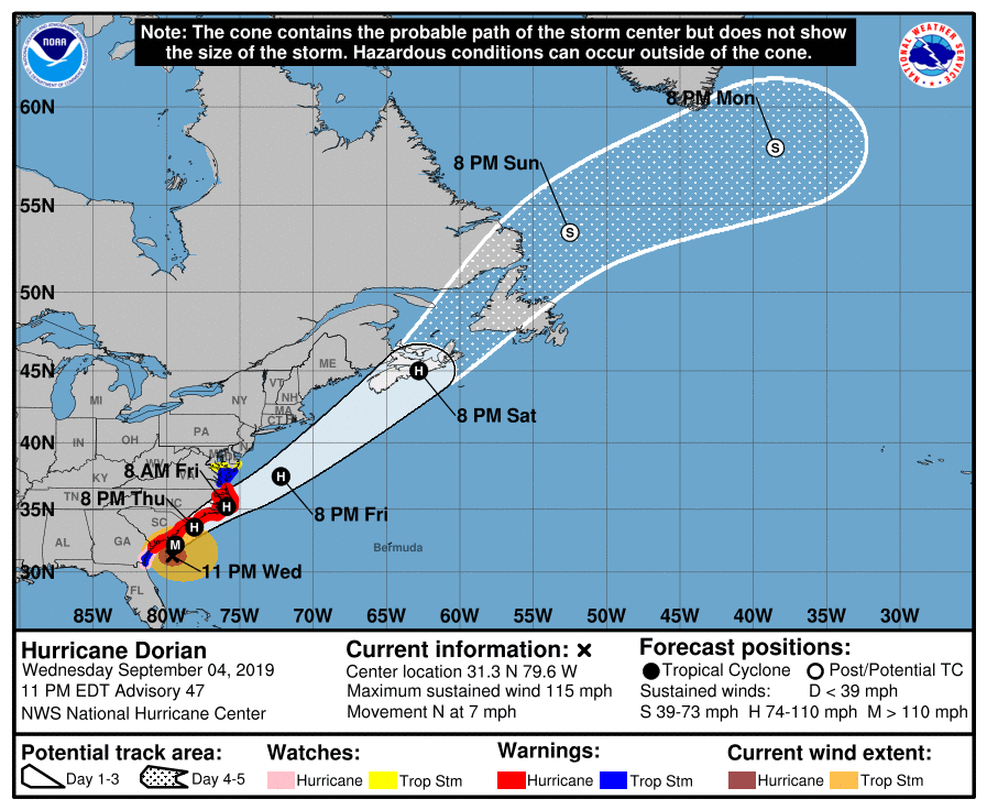
Hurricane Dorian continues to move up the East Coast, and has encountered the Gulf Stream and limited shear. That has allowed it to strengthen over the past several hours back and is now a Category 3 Major Hurricane. Currently located approx. 100 miles south of Charleston, SC.. many models indicate that landfall could occur somewhere between Myrtle Beach and Charleston tomorrow around noon or a couple of hours after. Then the eye wall will move up the coast in some fashion. Whether or not it scrapes the coast, or remains 25-50 miles off the coast will make huge difference. Below you can see the most recent HWRF model run and it has a landfall sometime late tomorrow afternoon.

courtesy of Tropicaltidbits.com

Contact my local trusted roofing source Matt at RedWolf Contracting Services to take care of all of your roof replacements. From shingles, to metal roofing, and even commercial rubber membrane, Matt has the resources and solutions to take care of your job in a professional and cost effective manner. Call (828) 772-9778 or visit nc-roofers.com to set up your free roof inspection.
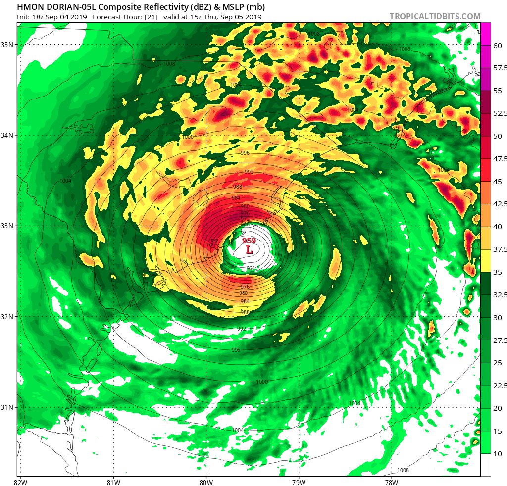
Another short range Hurricane models the HMON also shows a landfall tomorrow around noon between Charleston and Myrtle Beach. Winds could be sustained for 3-6 hours at 100 mph or higher for many beach locations tomorrow afternoon along SC beaches.

Courtesy of Tropicaltidbits.com
Then the storm would move up towards Wilmington late tomorrow evening. The forecast for this storm as to whether it would recurve and miss the coast has been a bit difficult, but I am really beginning to become concerned for both the NC and SC coasts. If these 100mph+ winds translate to the surface and inland, they will cause significant damage to the immediate coast. Beach communities all along the coast need to take evacuations seriously, the time is almost gone for you to leave. Storm surge will be massive will this storm, and will cause problems by flooding many roadways. Some locations could see a 10’+ storm surge. Watch the rendering below and you can see the possibility for track over the next 60 hours. Also, many locations will see over 6” of rainfall from Dorian, further complicating the situation.

courtesy of Tropicaltidbits.com
Impacts
The coastal areas have been preparing for this storm for many days, and it appears that it is coming to fruition. One blessing is that the storm will be moving somewhat faster than it was in the Bahamas, but the winds that could be unleashed will likely do severe damage to structures that are not adequately built. We have not seen a Major Category 3 Hurricane hit the Southeast Coast in nearly 25 years (Fran). The impacts from this will be long felt along many coastal areas, and I hope that the people in those locations have evacuated, or are prepared to experience strong winds over 90mph. Check our Facebook page tomorrow as we share more information regarding the storm!