
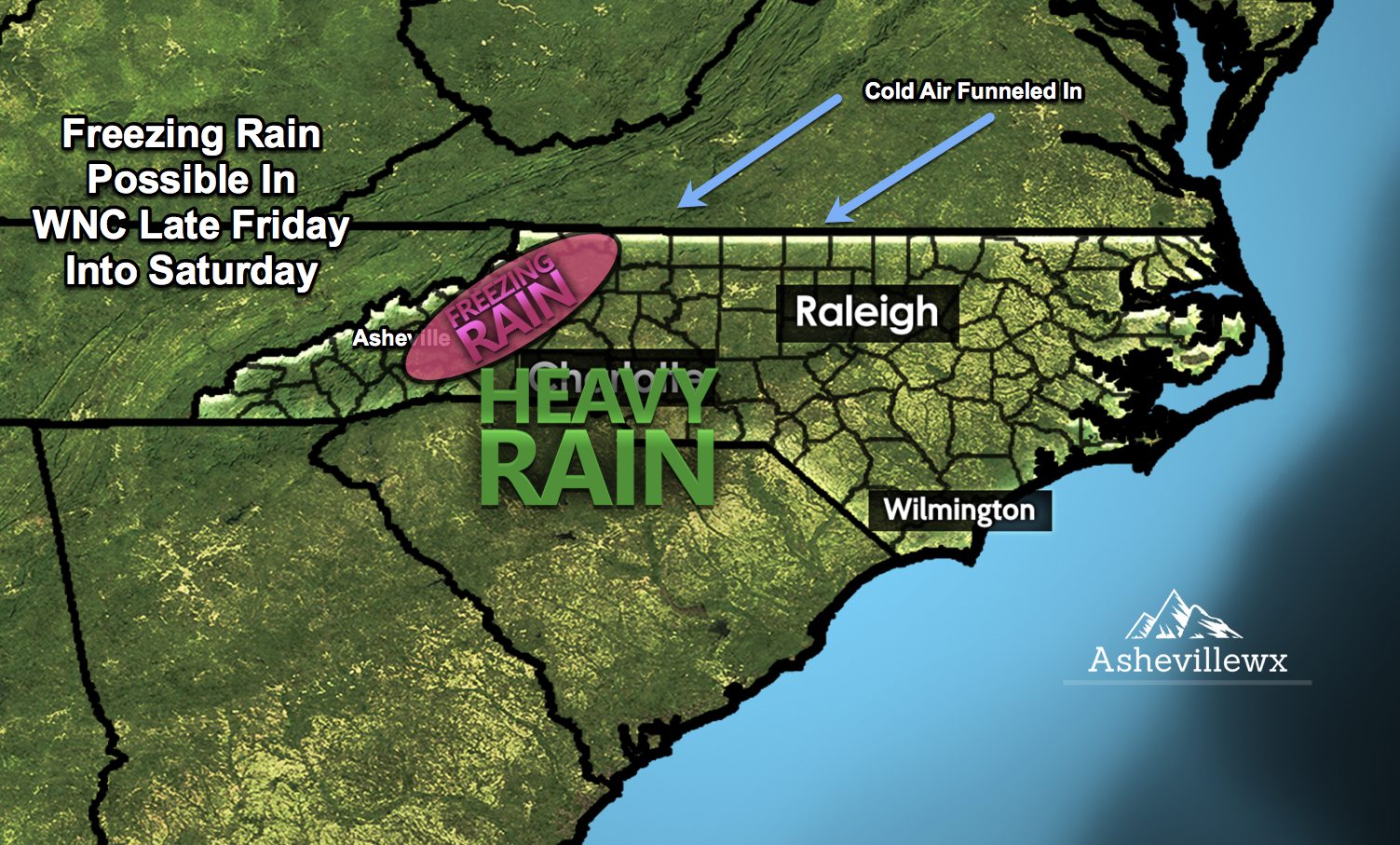
Freezing Rain Possible
As we progress toward this weekend, a front similar to what we saw last week will approach WNC. Cold air that is being funneled in from the NE will bank up against the mountains, creating a shallow layer of frozen air at the surface. Some models have locations along the Blue Ridge Escarpment pushing down into the mid 20’s Friday night as precipitation moves in, but that could be overdone. What does appear certain at the moment, is another heavy rainfall event. Upwards of 1” of rainfall will be likely for most areas Friday night into Saturday, so needless to say.. it will get soggy again.
European Model
The Euro is the coldest currently of all the model suites with the approaching storm. It has the strongest cold air wedge entrenched as precipitation approaches, but the Euro is not known for its ability to sniff out Cold Air Damming events. That is why I am somewhat skeptical that freezing rain will be widespread. The GFS has temperatures in the mid 30 when precipitation moves in, and that would not allow refreezing to occur. So the main take away currently is that this is an evolving situation, and a few degrees change in temp could mean a big difference in the p-type that you see at your location.
courtesy of weather.us

Looking To Build In WNC
Contact Larry or Hunter Ward (828) 691-5000 to discuss building your dream home in WNC!
