

Strong El Nino To Develop, Wetter Winter On Tap For WNC
A strong El Nino is in the process of coming to fruition and that historically has meant more precipitation flowing through NC during the winter months. Of course there is limited long range forecasting ability, but what we can do is compare and contrast from years in the past. NOAA recently released their winter forecast outlook based on upcoming patterns expected with Strong El Nino development. I share those same sentiments as I believe we could be in for a harsh winter here in WNC as well. If you have just moved here in the past two years or so, you may not have experienced the type of winters possible in the mountains of WNC. It appears as though you have a good likelihood of getting a really taste of a strong WNC winter this year.

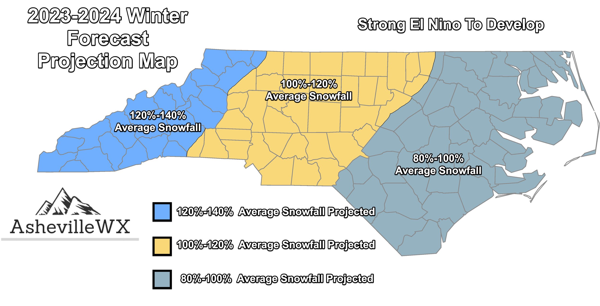
AshevilleWX Projected Snowfall Map For Winter 2023-2024
What Is El Nino?
El nino is when temperatures of water far out in the Pacific Ocean in a specific region drift higher than normal for more than 3 consecutive months. This higher than normal water temperature creates instability for low pressures to develop. With these frequent low pressures developing in this particular region know as Nino 3.4, storm traverse the Southeast with more consistency. Thus, NOAA is projecting a wetter than average January, February, & March for the Southeast (See Second Graphic Below).


Courtesy of NOAA
This projection lines up with past years where strong El Nino conditions have developed. With over a 50% chance a strong El Nino comes to fruition, there is a good chance we see excessive precipitation this winter. One year in particular that sticks out to me is 2009-2010 for WNC. That year many locations around Asheville received over 40” of snowfall! There is a chance this could happen again as it feels like we are due for a strong winter here in WNC.
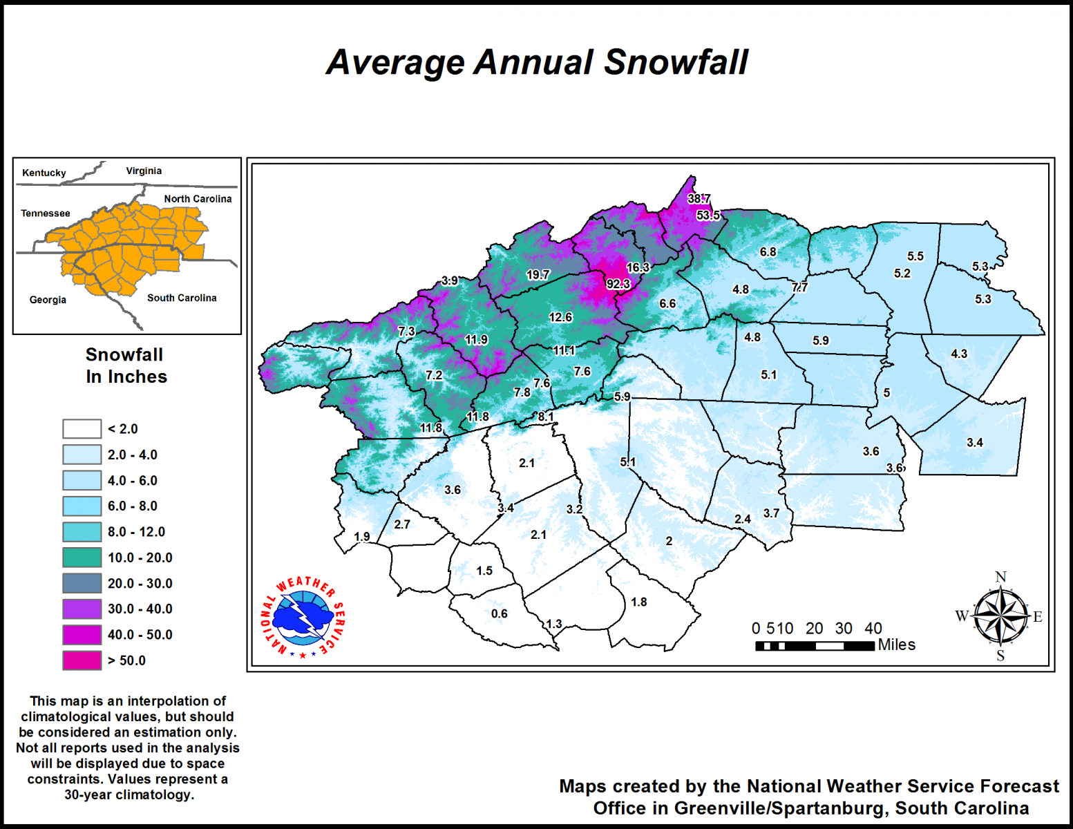
What Is The Average Around WNC?
Below you can see the Average Annual Snowfall Map provided by the National Weather Service In Greer, SC. Downtown Asheville averages around 12.6” of snowfall whereas the Asheville Airport on averages 11.1”. If projections are correct, Asheville could see 14”-18” of snowfall this coming winter. Similar math can be done for the surround areas.

Courtesy of GSP NWS
Uncertainty In Long Range Forecasting
I had stopped dong my long range winter forecast for a few years, but each year I get asked countless times if I am going to release it. My answer the past couple of years has been no due to so much uncertainty with the mountains of WNC. I mean we struggle to nail a forecast down 3 days up here. So how can we long range forecast with any certainty? Those were the questions I proposed to myself. I want to be known as truthful and honest, so I put the forecast off for the past few years. Today it returns because I think it is interesting to compare historical data and make projections for the future. Many industries do this, and the weather should be no different. Is there a chance this forecast is wrong, certainly! But understanding how moisture comes to fruition during winter is important, and long range forecasting allows us to set some perimeters for possible exceptions. Look for my forecasts to pick up here as we head into the winter and cold shots begin to show! Check back soon!


